Mark Twain once said,
" Whiskey is for drinking, water is for fighting over..."
How true that is along the Murray-Darling River system these days.....
and many other water and irrigation systems worldwide.....
(There's dispute as to whether Mark Twain was indeed the originator of this quote
but it certainly does match his wit so I'll stay with him....)
I had travelled along the Darling several times, both by air and road, and never saw a really flowing river, just stagnant greenish pools.... The recent drought had been devastating... Even the Menindee Lakes had dried up and massive fish kills... But this year there had been really good rain in northern NSW and southern Qld, and the run-off has filled the river to it's banks. I just had to see that, so flew down to follow the river and see it happen.
6.5 hrs in my Savannah from Kilcoy, SE Qld to Tilpa on the river. Tilpa is an excellent spot to view the river in action.

From the beer garden of the Tilpa pub, under the magnificent old River Red Gums.

Camped at Tilpa.
The peak of the flood had already passed Tilpa when I got there, but the river was still flowing well.
The peak flow was now at about Wilcania as we shall see below.

Here the flood has spread out over the flats.

And backed up the creek channels.
All that water will drain back into the river later.

An oxbow lake has formed here, when the river cut across the shortcut.

Here's a classic oxbow lake, or better known as a billabong in OZ, or a bayou in Louisiana...

The chain of 6 Menindee Lakes as seen from the north near to far.
Lake Balaka
Lake Bijijie
Lake Tandure
Lake Pamamaroo
Lake Menindee
Lake Cawndilla

The river flows into the system at Lake Pamamaroo,
and this is the entry point, with a good flow at present.

This is the man-made channel that connects
Lake Pamamaroo to the main Lake Menindee.

Predictions are that it will only reach 10% this flood event.
These lakes are vast in area but shallow,
so they are effective evaporation ponds.
Much of the water stored here just evaporates.....
I hiked over to the lake to taste the water,
but scads of roo poo was floating on the surface.
Could barely push enough aside for a handful of water.
Seems that the droppings from all over the dry lake now floated
and the wind concentrated it all this side....
 This is Lake Cawndilla, the last in the chain.

No water going in yet and not likely to get any this flood event.
On the OZRunways map I noticed an airfield marked in the
middle of Tandou Lake???

That didn't make sense so I had to go over and have a look,
and this is what I found.

It's really a dry lake bed that had been converted to a large irrigation farm!
Due to scattered cloud I couldn't get high enough for a good overall photo,
but this is how it looks on Google Maps.

Many miles of irrigation and drainage channels, would have cost a heap to develop.
It was first developed in the 70's and was productive in the 90's,
but a lack of dependable water supply caused it to fail after that.
Lots of dispute about the reasons for that decline in amount of water.
Some claim upstream water harvesting,
some claim government interference, no doubt about that....
But it's recognized that over-allocation in the past, all along the river,
even in good years, could never have been sustained.
Then of course the trend to lower rainfall makes it totally unsustainable as is.....
Lots of fighting about all these issues, just as the Mark Twain predicted......
And lots of hidden, convoluted, double-dealing as shown in this analysis.


History of the paddle steamers and the heyday of the Darling River.
All so different now from the 1870's, when the river was the 'highway' of the time.Wool was booming and hundreds of thousands of wool bales were transported down river
on barges towed by paddle steamers, heading for seaports to go to all the way to Britain.
At one time there were up to 90 such steamers on the river,
and the towns like Wilcannia and Bourke were major ports, with thousands employed.
Imagine all the timber-cutters sourcing the wood for all those boilers.
And all the stokers feeding that timber into a hot boiler in the hot weather.
In many places the river is so tortuous with winding bends that
they would have to steam three times the distance of the straight line.
And lots of shallow water with groundings and snags to be wrestled with...
Would have taken weeks for a journey that now takes a day by road.
Then the railways and roads took all the freight business from the river,
which is just as well because there's no way to move cargo these days
on what's left of the poor Darling River.....
Meanwhile, way upstream at the Queensland border....

This is part of Cubbie Station
That water in the background is floodplain harvested.
That is, miles of levee banks built to capture the water before it gets in the river,
and pumping it into massive on-farm storage reservoirs.....
It's very effective, so Cubbie Farm has plenty of water in storage for this year's crop
and probably enough left to do a crop next year.
Impressive production!

and is now owned 51% by Chinese and Japanese interests.
The injection of money from those interests and new expertise,
including floodplain harvesting,
has improved production dramatically.
There's lots of arguments about the pros and cons of floodplain harvesting.
There's a dispute about how much of that water would have reached the lower river anyhow.
Some of those arguments are in these links but there are pages of such discussion (argument).
Mark Twain was spot-on once again....
I have an interest in water use/abuse as in these flying blogs in the USA
Now for a very different river life on the lower Murray

It is a very different life on the lower Murray River.

They love their houseboats down there....

The mouth of the Murray River out to sea.
That's all there is left of the water from the Murray-Darling Basin......
A couple of dredges working to keep the channel clear.

Those barrages that keep the seawater out of Lake Alexandrina.
Fresh in Alexandrina on the left, salt in the Coorong on the right.

The Coorong goes for 145km like this.
While fueling mogas at Goolwa, I noticed that the weather was perfect.
So a quick flight over to Kangaroo Island before a winter weather front moves in.....

All those windbreak hedgerows indicate lots of cold wind here....


And swept along the roads, killing all these roadside trees.
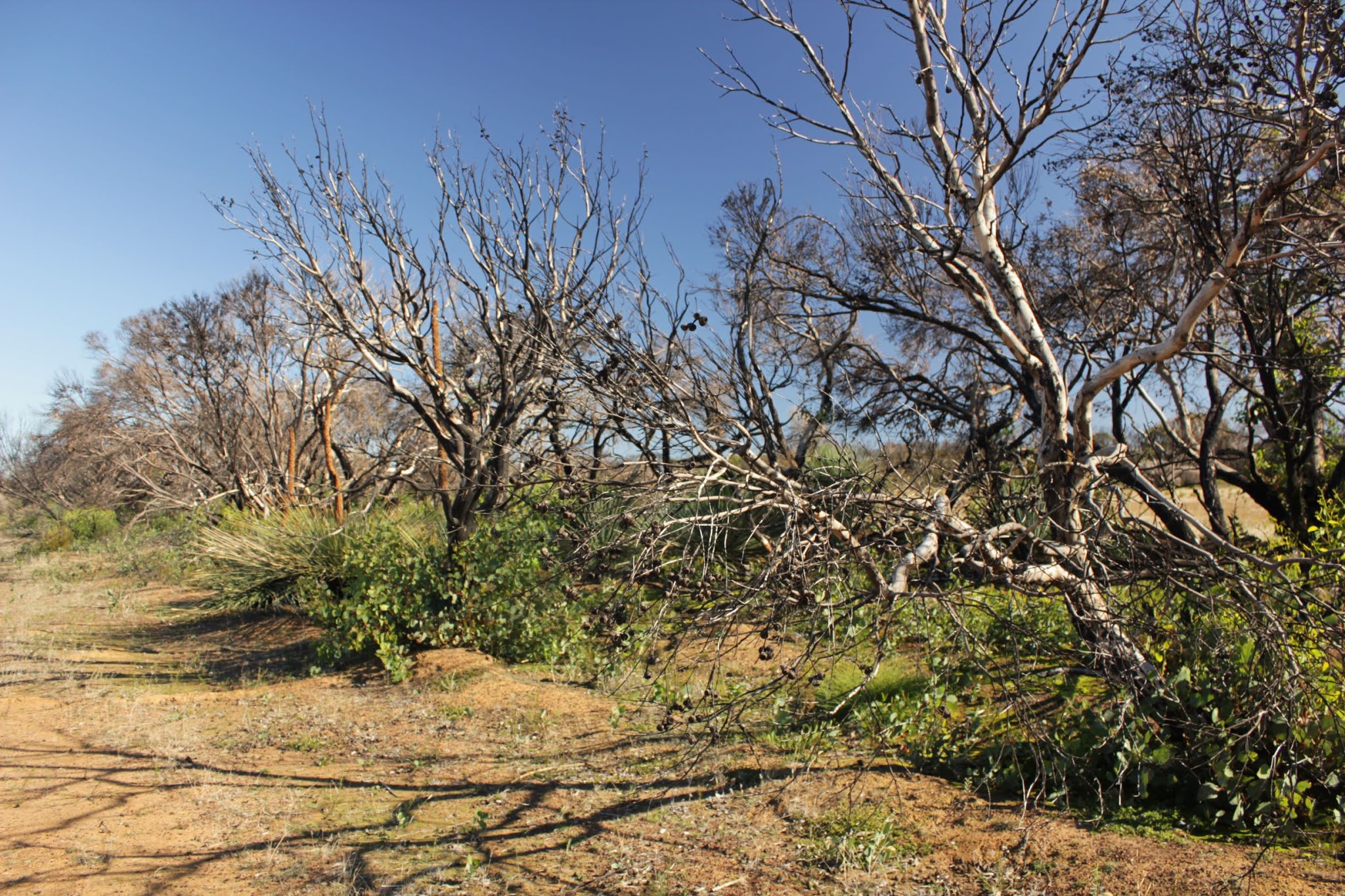


But have a look at the re-growth everywhere.
Australian bush is great for recovery from fire.
So it's really an opportunity for a new generation to get it's chance.
John Gilpin
May 2021
I am impressed, well done John👍
ReplyDeleteThanks JG! very good
ReplyDelete